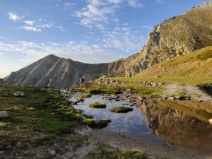
Bruguera – Taga – Bruguera
tinerary that rediscovers the royal path from Ribes de Freser to Ogassa crossing Bruguera (1 200 m above sea level), a small village nested in the sunny and western side of Taga.

Other routes of interest
-
Ulldeter Trail
-
Difficulty: Medium
-
Distance: 4.5km
-
Accumulated drop: 345m
-
Time: 1.25h
-
-
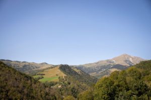
The great watchtower overlooking Vallespir. The Walking Tour of El Ripollès Option A
-
Difficulty: High
-
Distance: 14km
-
Accumulated drop: 450
-
Time: 4.25h
-
Ulldeter Trail
-
Difficulty: Medium
-
Distance: 4.5km
-
Accumulated drop: 345m
-
Time: 1.25h
The great watchtower overlooking Vallespir. The Walking Tour of El Ripollès Option A
-
Difficulty: High
-
Distance: 14km
-
Accumulated drop: 450
-
Time: 4.25h

Create your route
Create your route and download the application to your mobile phone so you can enjoy it instantly.

