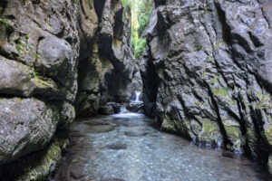
Route of camí de l’Exili. Route 1 Molló
DATA OF INTEREST
-
Route type:
Round trip -
Modality:
Walking -
Region:
Ripollès -
Municipalities:
Molló -
Difficulty:
High -
Time:
3h -
Distance:
9.5km -
Hauteur maximale:
1.540 -
Cumulative elevation gain:
649 -
Accumulated elevation gain:
729 -
Signaling:
Itinerànnia
The Molló municipality has three main escape routes across the border at the end of the war, the road from Espinavell to the Pregon pass which is what we follow with this route.
With the fall of Barcelona, on January 26, 1939, began what we currently call The Retreat. Hundreds of thousands of people fled Francoist troops in the direction of the French border.
From the end of January to the beginning of February of 1939 around 100,000 people, approximately, crossed through the valley of Camprodon.
The Molló municipality has three main escape routes across the border: The Ares pass Road (which was already operational in 1939 but had not quite reached the border point), the old road that ran from Camprodon to the Ares pass through the Casilla del Carrabiners and the road from Espinavell to the Pregon pass which is what we follow with this route.
Most roads hidden between mountains were widely used also by entrepreneurs, deserters, wealthy people and people related to the national movement, both from the region and from outside, many of whom, once in France, went to the Irun border, where they entered the Spain controlled by the Francoists.
After the Civil War, these paths continued to be used for different reasons. During World War II, they were used assiduously by Jews fleeing Nazi Germany. They used them to reach Prats de Molló or La Presta and, from there, they embarked on the last kilometres to the Spanish border, where some of the Crossers in the area that guided them were already waiting for them. Thus, they avoided the border surveillance of both the Germans and the Francoist regime.
After the Civil War and World War II, these paths were still used for a long time. In a Francoist Spain immersed in the middle of the post-war period and with a scarcity of materials and food, the turn of smugglers came. The inhabitants of the valley, taking advantage of their knowledge of the territory, crossed to France to make purchases and resell them, later, within the region. Some did so out of necessity, but others were enriched by this practice known as straperlo.
After the end of World War II, maquis (armed groups that opposed the establishment of the Francoist regime) also used these border mountain passes.
Miguel Quintana Peñalver, along with other colleagues, established the first base of operations of the anti-Francoist guerrillas in Mas La Sorrenguera, between Prats de Molló and La Presta. From this house they could cross the border by several points, mainly by Prats passes or the Pregon pass. Later, both this house and Grevodella (La Presta) were used by Francesc Sabater Llopart, Quico Sabaté.
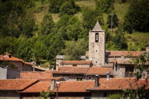
We leave Molló from the Itinerànnia R85 sign in Plaça Major and head towards Espinavell, to Espinavell the road, in addition to being marked with the yellow Itinerànnia markings, also has the GR151 markings.
After a few meters we find the junction R84 Molló dipòsit vell and continue in the direction of Espinavell. Along the way we find the country house of La Bola, crossroads M1 and dels Grells neighborhood crossroads M2, which will lead us to Espinavell where we will find the crossroads R88.
The houses of this nucleus were the last ones that Republicans saw before crossing the border, in the winter of 1939. Their inhabitants watched, perplexed, as this large number of people took the path to the border, and tried to help them, within their possibilities, giving them food and a roof, if appropriate.
Not all the exiles, however, arrived on foot. Some had been able to take vehicles and drive them up to Espinavell. In front of the village school (current Els Estudis refuge) vehicles could go no further and were dumped down the bank, so they were unusable for the enemy.
We follow the yellow signs direction Coll Pregon that also coincide with the white and red of the GR11.6 and the GRT79 (cross-border). The route from Espinavell La Farga (on the River Tec, reaching the Presta) was full of abandoned military and civilian objects. Faced with the impossibility of carrying them, discouragement, the steepness of the route, the snow, the cold or tiredness, many people ended up abandoning their belongings, which they had grabbed when leaving their homes, on the path.
After the Civil War ended, the inhabitants of Espinavell climbed to the Pregon pass to see if they could find anything value among all the abandoned objects, from Camprodon to Prats de Molló, also war objects could be found at any point along the routes that led to Northern Catalonia.
After Camprodon’s defensive combat, weapons no longer had virtually any meaning, and therefore divider walls, bridges, rivers, and shores became the main places to abandon this material. However, if they got near the border line and had not yet abandoned their weapons, the fighters stacked ammunition boxes, explosives, weapons and bolts to blow them up and thus prevent them from falling into the hands of the enemy.
Where we are right now was the last place where the material carried by the soldiers was blown up before crossing the Pregon pass. The blast of the accumulated boxes left the fields full of remains and, for years, the farmers of Espinavell found large quantities of ammunition, grenades, weapons bags and military objects. Even now it is not strange to find them, walking along the path.
We arrive at the R90 junction, the border point of Coll Pregon, and we will continue towards La Presta, where we will finish the route.
During the last days of the Civil War in Catalonia, a large number of wounded people from the front arrived in the Camprodon valley. From the improvised hospitals of Camprodon, once stabilized, the wounded were loaded in trucks in the direction of the border. There were those who took the road from the Ares pass and others that reached Espinavell. The latter had to be transported from Espinavell to the Presta on stretchers. The stretchers, normally, were carried by two soldiers, but there were also some loaded onto the mules. The hardness of the path, the cold, the frozen snow in the dark side of the ridge… made the transfer very difficult, meaning not all of them reached the Presta. Along the path that descends to the houses of La Farga (on the banks of the Tec River), many stretchers were abandoned that had carried casualty that had not managed to survive the transfer. The dead were buried and the stretchers, abandoned.

Other routes of interest
-
Queralbs route in the Forn district
-
Difficulty: Short
-
Distance: 2.20km
-
Accumulated drop: -
-
Time: 0.45h
-
-
Way from the crosses to the mines
-
Difficulty: Short
-
Distance: 6km
-
Accumulated drop: 410m
-
Time: 2h
-
Queralbs route in the Forn district
-
Difficulty: Short
-
Distance: 2.20km
-
Accumulated drop: -
-
Time: 0.45h
Way from the crosses to the mines
-
Difficulty: Short
-
Distance: 6km
-
Accumulated drop: 410m
-
Time: 2h

Create your route
Create your route and download the application to your mobile phone so you can enjoy it instantly.