Taga (Sant Martí d’Ogassa)
This trail starts at the church of Sant Martí d’Ogassa and takes you to the peak of the Taga mountain, which at 2,035 m above sea level is the highest in the Cavallera range and offers magnificent views of the surrounding countryside.

Other routes of interest
-
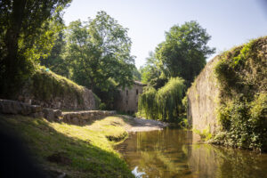
Sant Joan de les Abadesses's natural trail
-
Difficulty: Short
-
Distance: 2.30km
-
Accumulated drop: -
-
Time: 1.20h
-
-

Return to the Gra de Fajol
-
Difficulty: High
-
Distance: 10km
-
Accumulated drop: 950m
-
Time: 5.10h
-
Sant Joan de les Abadesses's natural trail
-
Difficulty: Short
-
Distance: 2.30km
-
Accumulated drop: -
-
Time: 1.20h
Return to the Gra de Fajol
-
Difficulty: High
-
Distance: 10km
-
Accumulated drop: 950m
-
Time: 5.10h

Create your route
Create your route and download the application to your mobile phone so you can enjoy it instantly.

